A neighbor sold his corner lot last year for $185,000. Three months later, the buyer discovered the lot was 1,400 square feet smaller than the listing claimed. The seller had measured from the sidewalk edge instead of the actual property pins, inflating the frontage by 8 feet on each side. That measurement mistake turned into a $22,000 dispute and six months of legal fees. The entire problem started with one decision: choosing the wrong method to measure the land.
Measuring land accurately is the first step in every square footage calculation. The formula is straightforward. Length times width for rectangles. Base times height divided by 2 for triangles. The challenge is getting the measurements right. A 3 percent error on a 10,000 square foot lot changes the area by 300 square feet. At $25 per square foot, that is $7,500 in mispriced value. This guide compares every measurement method, matches each one to the right situation, and walks you through the process for every land shape. The land square footage calculator on this site handles the math once you have accurate measurements.
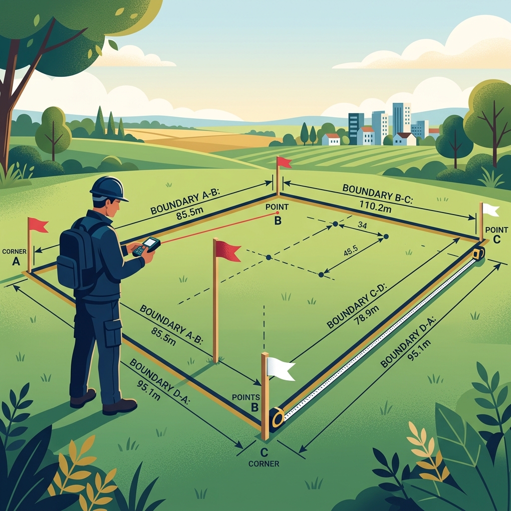
Accurate land measurement starts with choosing the right tool for your plot size and shape.
Why Is Accurate Land Measurement Important?
Every square footage calculation is only as good as the measurements behind it. The best formula in the world produces a wrong answer if the input numbers are off. Understanding why accuracy matters protects your wallet, your timeline, and your legal standing.
Why Accurate Measurements Matter
Land measurements drive financial decisions. Buyers calculate price per square foot to compare properties. Builders determine how much structure fits within zoning limits. Contractors estimate materials for fencing, grading, and landscaping. Appraisers set property values based on lot size. Tax assessors calculate annual property taxes using recorded area. Every one of these calculations depends on the same input: an accurate measurement of the land in square feet.
How Measurement Errors Affect Land Area Calculations
How Measurement Errors Multiply
VisualBased on a 10,000 sq ft lot valued at $25 per square foot.
A small error in measurement produces a large error in area. If you measure a 100-foot side as 97 feet, the 3-foot error on that side alone reduces a 100 by 100 lot from 10,000 to 9,700 square feet. Now multiply by the price per square foot. That single measurement mistake costs thousands. The error compounds further when both length and width are off.
When Accurate Land Measurement Is Essential
Four situations demand precise measurements: property transactions, construction planning, legal boundary determinations, and material estimation. Buying or selling land without verified measurements risks overpayment or underpayment. Building without accurate lot dimensions risks permit violations. Fencing without measured boundaries risks encroaching on a neighbor's property. Ordering sod, gravel, or concrete without correct area figures wastes hundreds of dollars in extra material or causes project delays from shortages.
What Tools Can You Use to Measure Land?
Six tools cover every land measurement scenario, from a backyard garden to a 50-acre farm. Each one excels in specific situations and falls short in others. Matching the right tool to your plot saves time and delivers the accuracy your project requires.
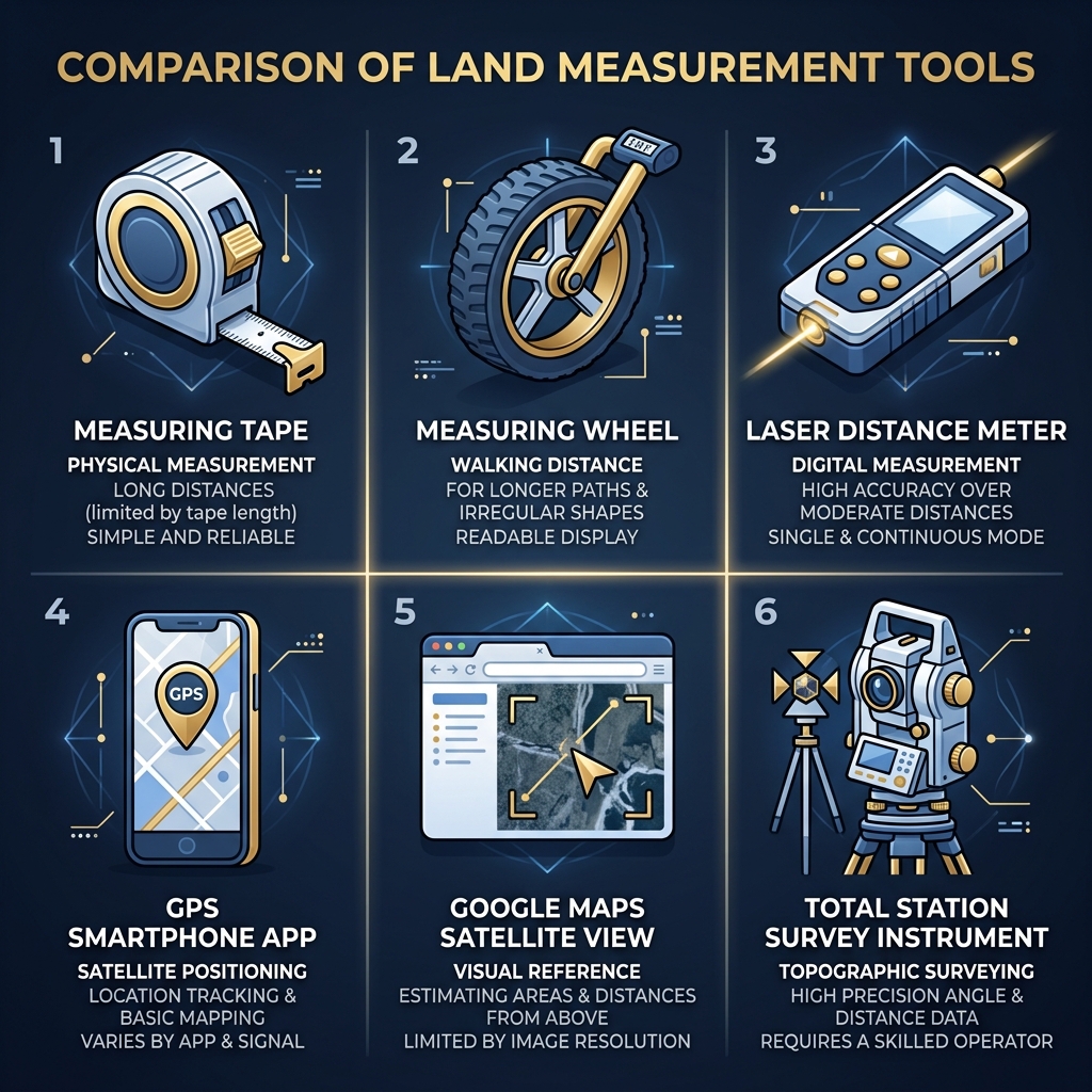
Choose the right tool based on your plot size, terrain, and required accuracy level.
Measuring Tape
A 100-foot fiberglass tape measure costs $15 to $30 and handles plots up to half an acre. Accuracy is within a quarter inch when the tape is pulled taut. The Stanley FatMax 100-foot tape and the Komelon Open Reel are both reliable options. Tape measures struggle on slopes, through brush, and on plots longer than 100 feet where you need to chain measurements together. Best for flat, rectangular lots under 10,000 square feet.
Measuring Wheel
A measuring wheel rolls along the ground and counts distance in feet. It costs $25 to $60 and handles uneven terrain better than a tape. The Komelon MK60 and the Milwaukee 10,000-foot wheel are popular choices. Accuracy is within 1 to 2 percent on flat surfaces but drops on soft ground where the wheel sinks. Best for long straight boundaries on firm surfaces like sidewalks, roads, and packed dirt.
Laser Distance Meter
A laser meter shoots a beam to a target and measures the distance instantly. Accuracy is within one-sixteenth of an inch up to 200 feet. The Bosch GLM 50 C (around $100) and the Leica Disto D2 (around $130) both connect to smartphone apps for recording measurements. Laser meters need a solid target surface at the far end. On open land, you need a helper holding a target board at each corner. Best for lots under one acre where you can reach every boundary line on foot.
GPS Land Measurement Apps
GPS apps on your smartphone track your position as you walk the boundary. Popular options include GPS Fields Area Measure (free with ads), Geo Measure Area Calculator (free), and Map Pad GPS ($5). Accuracy ranges from 3 to 10 feet depending on satellite coverage and device quality. GPS apps excel on large rural properties where tape measures and lasers cannot reach. Best for plots over one acre where 3 to 5 percent accuracy is acceptable.
Google Maps
Google Maps lets you measure distance and area without visiting the property. Right-click any point, select "Measure distance," and place pins along the boundary. Accuracy depends on image resolution and pin placement, typically within 3 to 5 feet in urban areas. Google Maps works for quick estimates and for measuring properties you have not yet visited. It does not replace physical measurement for transactions or construction.
Professional Survey Equipment
Licensed surveyors use total station instruments that measure angles and distances to within one-tenth of an inch. A full boundary survey costs $300 to $800 for a standard residential lot and $1,000 to $5,000 for commercial or rural parcels. Survey results are legally binding and hold up in court. The irregular plot measurement guide covers when professional equipment is worth the investment.
Land Measurement Tools Compared
Comparison| Tool | Cost | Accuracy | Best Range | Best For |
|---|---|---|---|---|
| Measuring Tape | $15-$30 | Within 0.25 in | Up to 100 ft | Small flat lots |
| Measuring Wheel | $25-$60 | Within 1-2% | Up to 1,000 ft | Long boundaries |
| Laser Meter | $80-$200 | Within 1/16 in | Up to 300 ft | Medium lots |
| GPS Apps | Free-$5 | Within 3-10 ft | Unlimited | Large rural land |
| Google Maps | Free | Within 3-5 ft | Unlimited | Remote estimates |
| Survey Equipment | $300-$5,000 | Within 0.1 in | Unlimited | Legal boundaries |
How Do You Measure Different Types of Land?
Each land shape requires different measurements and different techniques. Knowing what to measure before you start saves trips back to the property and prevents calculation errors. The any-shape square feet guide covers the formulas for each shape in detail.
Rectangular Land
Measurements Required
Length and width. Measure both pairs of opposite sides to confirm the shape is truly a rectangle. If opposite sides differ by more than 6 inches, the lot may be a trapezoid.
Best Measurement Method
Use a 100-foot tape measure or laser meter. Start at one corner stake, pull the tape to the opposite corner along the boundary. Record the length. Move to an adjacent corner and repeat for the width. A tape measure gives you the most accurate reading on flat ground for distances under 100 feet.
Square Land
Measurements Required
One side length. Measure all four sides to verify they are equal. Measure one diagonal to confirm right angles. The diagonal of a true square equals the side length times 1.414.
Best Measurement Method
A tape measure works perfectly for square lots. Measure each side and one diagonal. If all sides match within a quarter inch and the diagonal checks out, you have a true square. One measurement and one formula give you the area.
Triangular Land
Measurements Required
The base and the perpendicular height. The perpendicular height drops straight down from the tallest point to the base, forming a 90-degree angle. If you cannot measure the height directly, measure all three sides and use Heron's formula.
Best Measurement Method
A laser meter works best for triangular plots because you can shoot the perpendicular height without physically standing at the top point. Set the laser at the apex, aim straight down to the base, and record the distance. The triangle square footage calculator accepts either base-height or all three sides.
What to Measure for Each Shape
InteractiveCircular Land
Measurements Required
The radius or diameter. Measure straight across the widest point for the diameter. Divide by 2 for the radius. For semicircular lots at cul-de-sac ends, measure the diameter along the straight edge.
Best Measurement Method
A laser meter or long tape measure works for the diameter. Place a stake at the center, tie a string to it, and verify the edge is equidistant all around. For large circular areas, a GPS app walking the perimeter provides a faster estimate.
Trapezoid Land
Measurements Required
Both parallel sides and the perpendicular height between them. Measure along each parallel boundary. Then measure the perpendicular distance from one parallel side straight across to the other. Do not measure along the slanted side.
Best Measurement Method
A laser meter aimed perpendicular to the parallel sides gives the cleanest height measurement. Use a tape measure for both parallel sides. Trapezoids are common on curved streets where the front and back lot lines differ in length.
Irregular or Polygon Land
Measurements Required
All side lengths plus at least one diagonal. For complex polygons, record every corner coordinate using a GPS app. The more reference points you capture, the more accurate the final area calculation.
Best Measurement Method
GPS apps or a combination of tape and laser measurements work best. Walk each boundary with a GPS tracker running. Alternatively, measure every side and every diagonal with a tape or laser, then use the irregular shape calculator to compute the area from your measurements.
How Do You Measure Land Step by Step?
Follow these five steps on every land measurement project. The process takes 15 to 45 minutes depending on lot size and shape. Skipping any step introduces errors that cascade into your area calculation.
Step 1: Identify the Shape of the Land
Walk the entire perimeter before measuring anything. Count the corners. Note whether boundaries are straight or curved. Sketch the outline on paper or your phone. Label each corner with a letter. This sketch becomes your measurement plan and prevents you from missing a side. Identifying the shape also tells you which formula you will use for the area calculation.
Step 2: Choose the Right Measuring Tool
Match your tool to the plot. Tape measure for lots under 10,000 square feet with clear boundaries. Laser meter for medium lots with accessible corners. GPS app for large rural parcels. If the property is involved in a transaction over $50,000, plan on hiring a surveyor. The tool comparison table above shows the accuracy and cost range for each option.
Step 3: Measure Every Required Side
Start at corner A on your sketch. Measure to corner B. Record the distance with the unit clearly labeled. Move to corner B and measure to corner C. Continue around the perimeter until you return to corner A. For rectangles, you need two measurements. For irregular plots, you need every side plus diagonals. Pull tape measures taut. Hold laser meters steady. Walk GPS tracks at a consistent pace along the boundary line.
Step 4: Record Measurements in One Unit
Convert every reading to the same unit before doing any calculation. If your tape reads 85 feet 6 inches, write it as 85.5 feet. If your GPS reports in meters, convert to feet by multiplying by 3.281. Mixing units is the fastest way to produce a wrong area. Label every number with its unit the moment you record it.
Step 5: Double-Check Your Measurements
Remeasure the longest side. If the second reading matches the first within a quarter inch per 50 feet, your measurements are reliable. For rectangles, verify by measuring the diagonal. A 100 by 75 foot lot should have a diagonal of 125 feet. If it does not, one of your side measurements is off. The square footage calculator lets you plug in your verified dimensions and see the result instantly.
What Measurements Are Required for Each Land Shape?
Different shapes need different inputs. Measuring the wrong dimension wastes your time and produces an incorrect area. This quick reference tells you exactly what to measure.
Length and Width
Rectangles need length and width. Measure the two longest adjacent sides. Multiply them for area. This covers roughly 70 percent of all residential lot measurements.
Side Length
Squares need one side. Measure any side and square it. Verify all four sides are equal. If they are not, the plot is a rectangle or a parallelogram.
Base and Height
Triangles need the base and perpendicular height. The height must form a 90-degree angle with the base. Slant height is not the same as perpendicular height and will give a wrong answer.
Radius
Circles need the radius. Measure the diameter across the widest point and divide by 2. Use 3.14159 times the radius squared for area. Partial circles need the radius plus the arc angle.
Parallel Sides and Height
Trapezoids need both parallel sides and the perpendicular distance between them. Add the two parallel sides, divide by 2, and multiply by the height. Do not use the slanted sides in the calculation.
Multiple Sides and Diagonals
Irregular polygons need every side length plus at least one diagonal to break the shape into calculable triangles. For polygons with five or more sides, record coordinates at each corner and use the Shoelace Formula.
Measurement Quick Reference
ReferenceHow Can You Measure Land Using Google Maps?
Google Maps provides a free measurement tool that works from any computer or smartphone. It is useful for quick estimates and for measuring properties you have not yet visited in person.
Measuring Straight Boundaries
Open Google Maps on desktop. Right-click the first corner of the property. Select "Measure distance." Click each subsequent corner. The tool displays the total perimeter distance. For a rectangular lot, you need only two sides. Zoom in as far as possible to place pins precisely on property lines.
Measuring Irregular Plots
Place pins at every change of direction along the boundary. The more pins you place on curves and angles, the more accurate the measurement. Google Maps shows the enclosed area when you close the polygon by clicking back on the starting point. Accuracy depends on image quality and your ability to identify the true boundary in satellite view.
Checking Area Measurements
Compare Google Maps measurements against your field measurements. If they agree within 5 percent, both sources are likely reliable. Differences greater than 10 percent mean one source is wrong. Google Maps tends to be less accurate in areas with tree cover that obscures boundaries. Always treat Google Maps as an estimate, not a legal measurement.
How Can You Measure Land Using GPS Apps?
GPS apps turn your smartphone into a land measurement tool. They work by tracking your position as you walk the boundary and calculating the enclosed area from the recorded coordinates.
When GPS Apps Work Best
GPS apps excel on large open parcels in rural areas with clear sky visibility. They handle irregular boundaries naturally because the app records your position continuously as you walk. For properties over one acre, GPS is faster than chaining tape measurements across hundreds of feet.
Limitations of GPS Measurements
Consumer GPS is accurate to 3 to 10 feet. Under tree canopy, near tall buildings, or in valleys, accuracy drops to 15 feet or more. On a 50 by 100 foot lot, a 10-foot position error changes the calculated area by 500 to 1,000 square feet. GPS measurements are estimates, not survey-grade data.
Tips for Better Accuracy
Measure on clear days with open sky. Walk slowly and steadily along the boundary. Take three laps around the property and average the results. Turn on high-accuracy mode in your phone settings. Stand at each corner for 5 seconds to lock the position. These steps cut GPS error by 30 to 50 percent on most devices.
Common Mistakes When Measuring Land
Five measurement mistakes account for nearly every inaccurate land calculation. Knowing them in advance prevents errors that cost time and money.
Measuring from the Wrong Boundary
Fences, sidewalks, and driveways are not property lines. Fences often sit 6 to 12 inches inside the actual boundary. Sidewalks may be in the public right-of-way. Always measure from survey pins or property markers. If you cannot find the pins, hire a surveyor to locate them before measuring.
Mixing Different Units
Recording one side in feet and another in inches, meters, or yards without converting produces wildly wrong results. A 100-foot side entered as 100 inches makes the area 144 times smaller than reality. Write the unit next to every measurement. Convert everything to feet before calculating. The common calculation mistakes guide covers more unit errors and how to prevent them.
Skipping Diagonal Measurements
Without a diagonal, you cannot verify whether a four-sided lot is truly rectangular. A lot that looks like a 100 by 80 rectangle might actually be a parallelogram with a different area. One diagonal measurement takes 30 seconds and catches shape errors that change the area by hundreds of square feet.
Ignoring Irregular Corners
Rounded corners, clipped corners, and curved boundaries all reduce the actual area compared to a simple rectangle. Ignoring a 10-foot radius corner on a lot reduces the area by about 21.5 square feet per corner. On a lot with four rounded corners, that is 86 square feet of area you do not actually own.
Recording Incorrect Measurements
Transposing digits, dropping decimal points, and forgetting to write down the unit account for most recording errors. Writing "89" instead of "98" on a 100-foot-wide lot changes the area from 9,800 to 8,900 square feet. Read every measurement aloud before writing it down. Double-check digits immediately.
How Can You Improve Measurement Accuracy?
Five habits separate a reliable measurement from a guess. Build these into every measurement session.
Measure More Than Once
Measure every side at least twice. If readings differ by more than a quarter inch over 50 feet, measure a third time and use the average. Professional surveyors triple-measure every line. The extra 5 minutes catches errors that manual calculation cannot detect.
Use the Correct Measuring Tool
A 25-foot tape stretched across a 90-foot boundary introduces chain errors at every overlap point. Use a tool rated for your distance. A 100-foot tape for lots under 100 feet. A laser for 100 to 300 feet. GPS for anything larger. Matching tool to distance eliminates the most common accuracy problem.
Keep Measurements in One Unit
Pick feet. Convert everything to decimal feet before recording. 6 inches becomes 0.5 feet. 3 inches becomes 0.25 feet. 9 inches becomes 0.75 feet. Never mix feet and inches in the same calculation.
Verify with Property Documents
Compare your field measurements against the deed description, plat map, or tax assessor records. If your measurement and the recorded dimensions agree within 1 to 2 percent, your readings are solid. A larger gap means either the records are outdated or your field measurements need adjustment.
Hire a Licensed Surveyor When Needed
For transactions above $50,000, boundary disputes, and construction permits, a professional survey is worth the $300 to $800 investment. Survey-grade measurements hold up in court, satisfy lender requirements, and protect both buyer and seller.
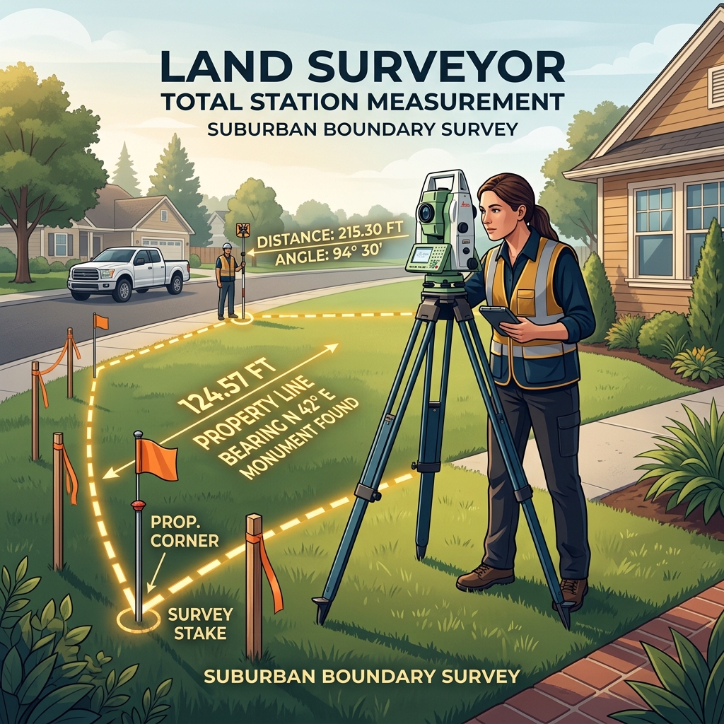
Professional surveyors deliver legally binding measurements accurate to one-tenth of an inch.
When Should You Hire a Professional Surveyor?
DIY measurement works for estimates, landscaping plans, and personal reference. Five situations require a licensed professional.
Property Purchase
Before closing on any land purchase, verify the area with a survey. Lenders often require one. The $300 to $800 survey cost protects a five- or six-figure investment. A $500 survey that catches a 1,000 square foot discrepancy on a $200,000 lot saves $20,000.
Property Sale
Sellers with a current survey can justify their asking price with documented square footage. Buyers trust verified measurements. A survey dated within the past two years satisfies most buyer and lender requirements.
Construction Projects
Building permits require documented lot dimensions. Setback calculations depend on accurate boundary positions. A structure built 2 feet over a setback line faces demolition orders or expensive modifications. A survey prevents this by establishing exact boundary positions.
Boundary Disputes
When neighbors disagree about where a property line falls, only a licensed surveyor's report resolves the issue. DIY measurements carry no legal weight. A surveyor's plat, stamped with their license number, is admissible in court and binding under local property law.
Legal Documentation
Subdivision plats, easement agreements, and zoning applications all require survey-grade measurements. County recording offices reject documents based on DIY measurements. A licensed survey satisfies every legal and administrative requirement.
What Should You Do After Measuring Land?
Raw measurements are just numbers until you calculate, convert, and verify. Four post-measurement steps turn your field data into actionable information.
Verify Your Measurements
Compare your readings against property records, Google Maps estimates, or a second set of field measurements. Agreement within 2 percent confirms your data is reliable.
Calculate Square Feet
Apply the correct formula for your shape. Length times width for rectangles. Base times height divided by 2 for triangles. Pi times radius squared for circles. The land area calculator handles every shape and eliminates arithmetic errors.
Convert Land Area into Other Units
Divide square feet by 43,560 for acres. Divide by 9 for square yards. Multiply by 0.0929 for square meters. Agricultural properties are discussed in acres. Carpet and sod are sometimes quoted per square yard. International buyers use square meters. The square feet to acres converter handles these conversions instantly.
Save Your Measurements for Future Use
Store your sketch, measurements, and calculated area in a property file. Include the date, tool used, and weather conditions. These records support future projects, contractor bids, insurance claims, and resale documentation.
Frequently Asked Questions
The best method depends on the land size and shape. For small rectangular plots, a 100-foot tape measure works well. For large or irregular land, a laser distance meter or GPS app delivers better accuracy. For legal transactions, hire a licensed surveyor with professional total station equipment.
A professional total station is the most accurate tool, measuring distances to within one-tenth of an inch. Laser distance meters are accurate to within one-sixteenth of an inch for distances up to 300 feet. GPS apps are accurate to within 3 to 10 feet depending on signal quality and device.
Yes. Google Maps lets you measure distance and area by placing pins along property boundaries. Right-click a starting point and select Measure Distance. Place pins along each boundary. The tool shows total distance and enclosed area. Accuracy is within 3 to 5 feet for most locations.
Yes. GPS-based apps like GPS Fields Area Measure, Geo Measure, and Map Pad GPS work by tracking your position as you walk the boundary. Accuracy ranges from 3 to 10 feet depending on satellite coverage. Phone-based measurements are useful for estimates but not for legal documents.
Break the irregular plot into smaller standard shapes like rectangles, triangles, and trapezoids. Measure each section separately, calculate the area of each, and add them together. For complex polygons, record the coordinates of each corner and use the Shoelace Formula or an online calculator.
Rectangles need length and width. Squares need one side length. Triangles need the base and perpendicular height. Circles need the radius. Trapezoids need both parallel sides and the perpendicular height. Irregular plots need all side lengths plus at least one diagonal measurement.
Consumer GPS apps are accurate to within 3 to 10 feet under clear sky conditions. Tree cover, buildings, and cloud cover reduce accuracy. For plots under 5,000 square feet, a 10-foot GPS error can change the calculated area by 5 to 8 percent. Always verify GPS measurements with a tape or laser.
Measure yourself for landscaping estimates, fence planning, and personal reference. Hire a licensed surveyor for property purchases above $50,000, boundary disputes, construction permits, and legal documentation. Survey costs range from $300 to $800 for a standard residential lot.
Measure every side at least twice. If the two readings differ by more than 2 inches over 100 feet, measure a third time and use the average. Professional surveyors take three readings on every line and average them. Double-checking adds five minutes and prevents costly errors.
Yes. A 10 percent measurement error on a $200,000 property changes the calculated value by $20,000. Lenders, appraisers, and tax assessors all rely on accurate area figures. Incorrect measurements can delay closings, trigger disputes, and result in overpayment or underpayment.
Appraisers compare recent sales of similar properties in the same area. They adjust for lot size, shape, location, zoning, access, and improvements. Accurate square footage is a primary input. The appraiser calculates price per square foot from comparable sales and applies it to the subject property.
Final Thoughts
The best method to measure land depends on three factors: the size of the plot, the shape of the boundaries, and the accuracy your project demands. A $20 tape measure handles small rectangular lots perfectly. A $100 laser meter covers medium properties with professional-grade precision. A $5 GPS app tackles large rural parcels. And a $500 licensed survey protects six-figure transactions with legally binding documentation.
Identify the land shape before choosing a measurement tool.
Match the tool to the distance: tape for short, laser for medium, GPS for large.
Measure every side at least twice and record in one consistent unit.
Use diagonals to verify shape before calculating area.
Hire a licensed surveyor for transactions, permits, and boundary disputes.
What land are you measuring today? Whether it is a backyard for a fence quote, a vacant lot for a purchase offer, or a farm field for crop planning, the right measurement method puts accurate numbers into every formula that follows. Get the measurement right, and the square footage takes care of itself.