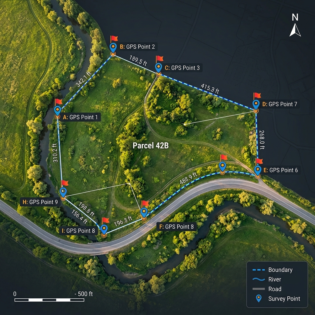
Last spring, a homeowner in Texas contacted me after discovering her property was 1,200 square feet smaller than what the county tax records showed. She had been overpaying property taxes for seven years. The culprit was an outdated survey that used a single tape measurement across an irregular lot with a creek running through one corner. That creek boundary made the difference between 0.38 acres and 0.41 acres, which translated to roughly $340 in excess taxes each year. Measuring an irregular plot is not just a technical exercise. It has real financial consequences.
Whether you are buying land, planning a fence installation, or settling a boundary dispute with a neighbor, you need the right measurement method for your situation. This guide walks through every practical approach I have tested across residential, agricultural, and commercial projects. You will find honest cost comparisons, accuracy ratings, and clear recommendations based on your specific needs. For a quick area estimate right now, try our irregular shape area calculator and enter your measurements directly.
The Best Method Depends on Your Situation
There is no single best method for every scenario. The right choice depends on your plot size, accuracy requirements, budget, and intended use. Here is a breakdown by common situations.
Best method for homeowners
A long tape measure combined with an online area calculator handles most residential needs. Walk the boundary, record measurements at each corner, divide the plot into triangles, and let the calculator do the math. This approach costs nothing beyond the tape measure you already own and delivers accuracy within 3 to 5 percent for most residential lots.
Best method for farmers and agricultural land
A handheld GPS device or smartphone GPS app provides the best balance of speed and accuracy for large agricultural parcels. Walk the perimeter while the device logs waypoints. Apps like GPS Fields Area Measure calculate the enclosed area automatically. For fields over 10 acres, drone surveying saves significant time compared to walking the entire boundary.
Best method for construction projects
Construction projects demand professional-grade accuracy. A total station survey provides certified measurements that satisfy building permit requirements. For site grading and earthwork calculations, drone photogrammetry adds elevation data that a flat boundary survey cannot capture.
Best method for commercial properties
Commercial transactions require a licensed surveyor with a total station or RTK GPS system. The resulting survey certificate carries legal weight for property transfers, zoning applications, and insurance assessments. Cutting corners here creates liability that far exceeds the survey cost.
Best method for legal boundary verification
Only a licensed professional land surveyor can produce a boundary survey that holds up in court. Total station measurements combined with deed research and monument recovery form the standard for legal boundary establishment. No GPS app, drone, or online calculator can replace this process when property ownership is at stake.
Why Is Measuring an Irregular Plot More Challenging Than a Regular Plot?
A rectangular lot needs two measurements: length and width. An irregular plot breaks every shortcut. Here is what makes the job harder and why the right tool matters more than raw effort.
Uneven property boundaries
Property lines that follow old fence rows, stone walls, or road curves create boundaries with no consistent pattern. Each direction change requires a new measurement point. Missing even one corner point throws off the entire area calculation.
Irregular shapes and curved edges
Boundaries that follow rivers, creeks, or curved roads cannot be captured with straight-line measurements alone. You need to approximate the curve with many closely spaced points or use GPS tracking that records your path continuously as you walk the boundary.
Natural obstacles
Trees, dense brush, steep slopes, and water features block direct line-of-sight measurements. A tape measure is useless across a pond. A total station cannot shoot through thick forest. These obstacles force you to choose measurement methods that work around physical barriers.
Large land areas
Walking the perimeter of a 40-acre parcel with a tape measure takes an entire day and introduces cumulative measurement errors at every turn. GPS and drone methods reduce a full-day manual job to under two hours with better accuracy.
Measurement accuracy challenges
Every measurement method has an error margin. Tape measures stretch and sag. GPS signals bounce off trees and buildings. Drone cameras distort at the edges of each photograph. Understanding these limitations prevents you from trusting a measurement more than it deserves.

Which Methods Can Be Used to Measure an Irregular Plot?
Six practical methods cover every real-world scenario. Each has distinct strengths, and the right choice depends on your situation rather than any universal ranking.
Manual tape measurement (overview only)
The most accessible method. Stretch a tape measure along each boundary segment, record the distances, and apply geometric formulas to calculate the enclosed area. Best suited for small, accessible plots under one acre.
GPS land measurement
Handheld GPS devices and smartphone apps record your position as you walk the boundary. The software calculates the enclosed area automatically. Consumer GPS reaches 10 to 15 feet accuracy. Survey-grade RTK GPS achieves centimeter precision.
Drone and aerial surveying
Drones capture hundreds of overlapping photographs that specialized software stitches into high-resolution maps. Photogrammetry processing extracts precise boundary coordinates and area measurements. A DJI Mini 4 Pro (around $760 as of July 2025) handles plots up to 50 acres per flight.
Total Station surveying
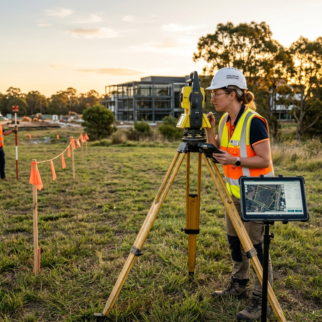
The professional standard. A total station measures angles and distances electronically to each boundary point. Combined with a prism rod at each corner, this method delivers the highest accuracy available for ground-based surveying.
GIS and mapping software
Geographic Information System software processes satellite imagery, GPS coordinates, and survey data into detailed maps with automatic area calculations. ArcGIS and QGIS are industry standards for large-scale land analysis.
Online land area calculators
Web-based tools accept your measurements or coordinates and return instant area results. They eliminate arithmetic errors and handle complex polygon calculations automatically. For detailed formulas and step-by-step calculation methods, read our guide on what is an irregular shape and how is its area calculated.
Comparing the Best Methods for Measuring Irregular Land
Method Comparison Matrix
Interactive| Factor | Manual Tape | GPS Device | Drone Survey | Total Station | Online Calculator |
|---|---|---|---|---|---|
| Accuracy | 3-5% | 1-3% | 0.5-1% | 0.01% | Depends on input |
| Cost | $0-30 | $100-500 | $760-2,000+ | $300-800 (hire) | Free |
| Time Required | 1-4 hours | 30-90 min | 1-2 hours | 2-4 hours | 5-10 min |
| Ease of Use | Easy | Moderate | Advanced | Expert only | Very easy |
| Equipment | Tape, stakes | GPS device/phone | Drone, software | Total station, prism | Computer/phone |
| Best For | Small lots | Farms, mid-size | Large parcels | Legal surveys | Quick estimates |
| Limitations | Large plots, obstacles | Tree cover, urban canyons | Regulations, weather | Cost, availability | No field data |
How to Choose the Right Measurement Method
Five factors determine which method fits your project. Work through each one to narrow down your best option.
Based on land size
Plots under half an acre respond well to manual tape measurement. Parcels between half an acre and 10 acres suit GPS devices. Anything over 10 acres benefits from drone surveying or professional equipment. The land area calculator handles any size once you have the measurements.
Based on required accuracy
Rough estimates for garden planning tolerate 5 percent error. Fencing projects need 2 to 3 percent accuracy. Construction permits require sub-1-percent precision. Legal boundary surveys demand accuracy within 1 part per 10,000.
Based on your budget
Zero budget means tape measure and a free online calculator. Under $200 opens smartphone GPS apps with premium features. A $300 to $800 investment covers a professional survey for one property. Frequent surveying justifies purchasing your own GPS or drone equipment.
Based on available equipment
Use what you have before buying new tools. A smartphone with a GPS app is already in your pocket. A 100-foot tape measure costs under $20. Only invest in specialized equipment when your project frequency or accuracy requirements justify the expense.
Based on legal requirements
Property sales, subdivision applications, and building permits typically require a certified survey from a licensed professional. No DIY method satisfies these legal standards regardless of how carefully you measure.
What Information Do You Need Before Measuring an Irregular Plot?
Gathering the right data before you start measuring prevents wasted trips back to the site. Here is your pre-measurement checklist.
Boundary points
Identify every corner and direction change along the property boundary. Mark each point with a stake, flag, or spray paint before measuring. Missing a boundary point means missing part of the area.
GPS coordinates
If using GPS or drone methods, record the latitude and longitude of each boundary corner. These coordinates feed directly into area calculation formulas and mapping software.
Property maps or survey plans
Check your county recorder's office for existing survey plats. Old surveys provide reference points and historical boundary information that help verify your new measurements.
Measurement units
Decide on feet, meters, or another unit before starting. Record all measurements in the same unit. The meters to square feet converter handles unit transitions when you need to compare measurements taken in different systems.
Existing land records
Property deeds, tax assessor records, and title documents contain legal descriptions with bearings and distances. These records serve as a baseline for verifying your field measurements.
How Accurate Are Different Land Measurement Methods?
Accuracy Comparison
VisualLonger bars indicate higher accuracy. All values represent typical field conditions.
Factors affecting measurement accuracy
Weather conditions, terrain slope, satellite coverage, operator experience, and equipment calibration all influence measurement quality. Dense tree canopy degrades GPS accuracy by 30 to 50 percent. Slopes over 15 degrees require distance corrections that add 2 to 6 percent to horizontal measurements if ignored.
How Much Does Each Measurement Method Cost?
Cost Breakdown by Method
ReferenceManual Measurement vs. GPS vs. Professional Surveying vs. Online Calculators
Which is the fastest?
Online calculators deliver results in under a minute once you have measurements. GPS walk-around surveys take 30 to 90 minutes in the field. Manual tape measurement requires 1 to 4 hours depending on plot size. Professional surveys take 2 to 4 hours on site plus processing time.
Which is the most accurate?
Professional total station surveys are the most accurate at 0.01 percent error. RTK GPS follows closely at centimeter-level precision. Drone photogrammetry achieves 1 to 3 centimeter accuracy with ground control points. Manual tape and consumer GPS trail significantly behind.
Which is the easiest?
Online calculators require the least technical skill. Manual tape measurement needs only basic geometry knowledge. GPS apps automate most calculations. Total stations and drones require trained operators.
Which provides the best value?
For a single property, hiring a professional surveyor at $300 to $800 provides certified results without equipment investment. For repeated measurements across multiple properties, a handheld GPS device pays for itself after three to four projects.
Which method should you choose?
Match the method to your stakes. Low-stakes garden planning calls for tape and a free calculator. Medium-stakes fencing or landscaping warrants a GPS device. High-stakes property sales and legal matters demand a licensed surveyor.
Common Mistakes When Measuring an Irregular Plot
Missing boundary points
Skipping a corner or direction change creates a simplified polygon that underestimates or overestimates the true area. A five-sided plot measured as four sides can produce errors of 10 percent or more.
Using inconsistent units
Mixing feet and meters within the same measurement set produces meaningless results. Convert everything to one system before any calculations.
Ignoring terrain and elevation
Slope distance is always longer than horizontal distance. A 20-percent slope adds roughly 2 percent to measured distances. Ignoring this correction inflates your calculated area.
Incorrect GPS readings
Recording GPS points under dense tree cover, next to tall buildings, or during poor satellite geometry produces inaccurate coordinates. Always check the GPS accuracy indicator before logging a waypoint.
Not verifying property boundaries
Measuring along a fence line that does not follow the legal property boundary gives you the fence area, not the property area. Verify boundary locations against deed descriptions before measuring.
Tips for Measuring Land More Accurately
Walk the complete boundary
Walk the entire perimeter before taking any measurements. Identify obstacles, direction changes, and access challenges. This reconnaissance prevents surprises mid-measurement.
Measure more than once
Take every critical measurement at least twice. If the two readings differ by more than 2 percent, measure a third time and use the median value.
Verify GPS coordinates
Plot your recorded GPS coordinates on a satellite image to confirm they align with visible boundary features. A transposed digit in one coordinate can shift a point by hundreds of feet.
Use consistent measurement units
Pick feet or meters at the start and use that unit exclusively. Convert all measurements to the chosen unit before entering them into any calculator or formula.
Validate results before finalizing
Cross-check your calculated area against county tax records, old surveys, or a rough Google Earth measurement. If your result differs from existing records by more than 5 percent, investigate before relying on your number.
When Should You Hire a Professional Land Surveyor?
Property boundary disputes
A licensed surveyor's boundary determination carries legal authority. DIY measurements do not hold weight in court or mediation proceedings.
Land subdivision
Dividing a parcel into smaller lots requires a subdivision plat prepared by a licensed surveyor and approved by local government.
Commercial developments
Zoning compliance, setback calculations, and building coverage ratios all require certified survey data. No planning department accepts self-measured dimensions.
Government approvals
Environmental permits, wetland delineation, and utility easements reference professional survey coordinates. Government agencies require licensed survey documentation.
High-value real estate transactions
Title insurance companies and mortgage lenders require current surveys for properties above certain value thresholds. The $500 survey cost protects against boundary issues on a $500,000 purchase.
When Are Online Land Area Calculators Not Enough?
Online calculators excel at processing measurements you already have. They fall short when the situation demands certified documentation or specialized field skills.
Legal property documentation
Courts and government agencies require signed and sealed survey documents. A calculator output does not satisfy legal standards.
Boundary conflicts
When neighbors disagree about a shared boundary, a calculator cannot resolve the dispute. You need a surveyor who can locate original boundary monuments and interpret deed descriptions.
Steep or uneven terrain
Calculators work with flat, two-dimensional measurements. Steep terrain requires slope corrections that most online tools do not apply automatically.
Complex commercial sites
Multi-parcel developments, easement areas, and building setback calculations require spatial analysis beyond what a simple area calculator provides.
Official land registration
Registering a new parcel with the county requires a legal description and plat map prepared by a licensed surveyor. Calculator results alone cannot support land registration.
Real-World Applications of Irregular Land Measurement
Buying and selling property
Accurate area measurement directly affects property valuation. Price-per-square-foot calculations depend entirely on correct area figures.
Agriculture and farm planning
Seed rates, fertilizer quantities, and irrigation system sizing all scale with field area. A 5 percent measurement error on a 100-acre farm means misallocating inputs for 5 acres.
Construction site planning
Excavation volumes, foundation layouts, and material estimates start with the measured site area. The concrete estimation guide shows how area measurements translate directly into material quantities.
Landscaping projects
Sod, mulch, gravel, and decorative stone are all priced per square foot. Accurate area measurement prevents both waste from over-ordering and project delays from under-ordering.
Fence installation
Fencing materials are priced per linear foot of perimeter, but the enclosed area determines the property value being protected. Both measurements matter for complete project planning.
Property tax assessment
Property taxes are often based on lot size. An incorrect area measurement in county records can result in years of overpayment or underpayment.
Urban planning
Zoning ordinances specify minimum lot sizes, maximum building coverage ratios, and required open space percentages. All these calculations start with accurate lot area measurement.
Frequently Asked Questions
The best method depends on your needs. For personal use, tape measurement with an online calculator works well. For legal or commercial purposes, hire a licensed surveyor with a total station. GPS devices offer the best middle-ground for farmers and mid-size property owners.
Consumer GPS is accurate to 10 to 15 feet, suitable only for rough estimates. Survey-grade RTK GPS achieves centimeter accuracy and is appropriate for most professional applications. Always check the accuracy rating of your specific device before relying on its readings.
Yes. Google Earth Pro includes a polygon area measurement tool. Drop pins along the boundary, close the polygon, and read the calculated area. Accuracy is typically within 5 to 10 percent. This method works for estimates but not for legal or commercial purposes.
A total station operated by a licensed surveyor delivers the highest accuracy, typically within 0.01 percent. RTK GPS and drone photogrammetry with ground control points follow closely at centimeter-level precision.
You need a professional surveyor for property sales, boundary disputes, subdivision applications, building permits, and any situation requiring legally certified measurements. For personal planning and estimation, DIY methods are usually sufficient.
A tape measure combined with a free online area calculator provides good results for most homeowner needs. For larger lots, a smartphone GPS app offers faster coverage. Both methods deliver accuracy within 3 to 5 percent for typical residential properties.
Use square feet for small residential lots. Use acres for parcels over half an acre. Use hectares for metric-system countries. The critical rule is consistency. Never mix units within a single measurement session.
Online calculators produce accurate results when you provide accurate measurements. They eliminate math errors and apply correct formulas. The output quality depends entirely on the quality of your input data.
Residential surveys typically cost $300 to $800. Commercial and complex surveys range from $1,000 to $5,000. Costs vary by property size, terrain difficulty, and local market rates. Always get at least two quotes.
Yes. For personal use, divide the plot into triangles using a tape measure, calculate each area, and sum them. Use an online calculator to verify your results. Self-measurement works for planning purposes but not for legal documentation.
Final Recommendation: Which Method Should You Choose?
Best overall method
A handheld GPS device combined with an online area calculator offers the best combination of accuracy, speed, and affordability for most people measuring irregular land.
Best free method
Manual tape measurement with our free online calculator costs nothing and delivers results within 3 to 5 percent accuracy for plots you can physically walk.
Best method for homeowners
A smartphone GPS app for boundary capture and an online calculator for area computation. Total investment: under $10 for a premium app. Time: 30 to 60 minutes.
Best method for professionals
A total station for boundary establishment combined with drone photogrammetry for large-area coverage. This combination delivers legal-grade accuracy with efficient large-site handling.
Key takeaways
No single method fits every situation. Match your tool to your stakes: free calculators for rough estimates, GPS for practical field measurements, and licensed surveyors for anything involving legal or financial consequences. The measurement method matters less than choosing the right level of precision for your specific need.
Try our Irregular Shape Area Calculator for quick area estimation
Ready to calculate the area of your irregular plot right now? Our Irregular Shape Area Calculator lets you input boundary measurements, divide any shape into triangles and rectangles, and get an instant area result. Give it a try and compare the result against your field measurements. What measurement challenge brought you here today?